Rating: NNNNN
Humber River Pedestrian Bridge
A structural marvel whose thunderbird-motif arches and panels of native imagery symbolically link water and sky, earth and air, the Humber Pedestrian Bridge spans what was once one of North America’s busiest native trade routes. Archaeologists have unearthed artifacts in the area that originated from the Ohio Valley, the Gulf of Mexico, the north shore of Lake Superior, James Bay, the western plains and the Pacific coast. Digs have also found evidence of longhouses and palisades along the Humber River.
Toronto Islands

A spiritual place where native people journeyed for healing rituals, moon ceremonies and sweats. The CN Tower, from which this shot of the shoreline is taken, is itself built on an archaeological site. Various artifacts were found there when excavation for the tower began in the mid-1970s.
Fort York

The military garrison seems an unlikely sacred place for natives, but Anishnaabek warriors fought there alongside the redcoats against the Americans in the War of 1812. First Nations people also camped nearby on the present-day CNE Grounds, where they sold and traded crafts and goods and performed in “Wild West” shows. Just to the south, at today’s Ontario Place, the first native land council was held in the 1820s to protest the encroachment by white settlers on native hunting and fishing grounds.
Withrow Avenue Public School
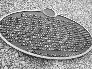
As long as 4,000 years ago, the plateau overlooking the Don River Valley here provided an excellent vantage point for game for native families who used the area as a campsite during hunting season. Native artifacts, were uncovered here by workers digging a roadbed in 1886.
Berczy Park

Named after settler William von Moll Berczy, this site adjacent to the old warehouses that once lined the original shore of Lake Ontario was a native fish camp – a creek used to flow along present-day Church Street – before the white man arrived.
Casa Loma

The castle sits atop a former Mississauga council ground, a bluff marking the shoreline of the ancient Lake Iroquois. Spadina, the street on which Casa Loma is located, comes from the Anishnabe term “Ishpaadina,” meaning “the clump of land you see out there,” a reference to the Toronto Islands, which are visible from here.
Tabor Hill Ossuary
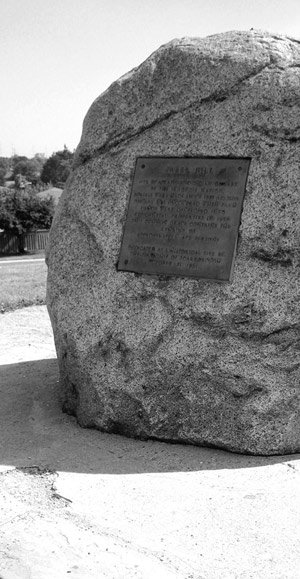
On a grassy hill overlooking Bellamy Road, a giant rock marks the Tabor Hill Ossuary, a burial pit containing the remains of some 470 Iroquois. The burials are believed to date from the 14th century, and the site was excavated during the building of a subdivision in 1956. The remains were first thought to come from a mass funeral, but native dead were often left on scaffolds in the woods and their bones later collected, cleaned and reburied in mass pits. A Feast of the Dead ceremony attended by Scarborough city officials and First Nations people marked the reburial of the remains in 1961.
Further north, off Kennedy just south of Steeles, evidence of another 14th-century Iroquoian village was unearthed in 2000 during a routine archaeological assessment along Highland Creek in preparation for a new subdivision. The Alexandra site, as it’s called, yielded evidence of 17 house structures and an astounding 19,000 artifacts over a 2-hectare area.


