Walk one: Gates Gully Bellamy Ravine
Access: Ravine Drive south of Bellamy and Kingston
Ten-thousand-year-old artifacts, a passageway for smugglers, a secret stash of treasure and a sanctuary for artists – Gates Gully is a magnificent part of our urban wilderness, a place of legends, legacy and beauty.
In the early 19th century, Bellamy and Kingston was home to an inn built by Jonathan Gates. On the night of December 5, 1837, it served as a rallying point for the militia aiming to defend Toronto against the erupting threat of William Lyon Mackenzie and his rebels. The gully was named for Gates and his inn.
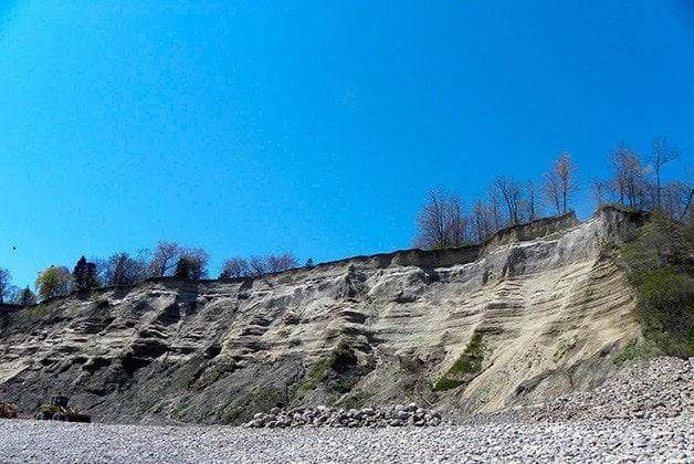
We start at the northern end of the trail, named for Canadian artist Doris McCarthy, which winds through nearly 24 hectares of ravine, dropping about 90 metres in elevation from the plateau atop the Scarborough Bluffs, one of the geological marvels of North America, down to Lake Ontario. It’s one of the few places on the Bluffs affording convenient access between the lake and the flats above.

The ravine is the earliest known site of human occupation in the GTA. Relics unearthed here have been dated from the early archaic period (circa 8000 BC). When European settlers arrived, they continued to use Gates Gully as an access route to and from the lake it was a gentle enough incline to wheel cargo up, convenient for soldiers, merchants – and smugglers.
The trail shadows Bellamy Ravine Creek, now a combined engineered drainage channel and natural waterway. Native species like white and yellow birch, American beech, white oak and sugar maple flourish on the steep surrounding slopes.
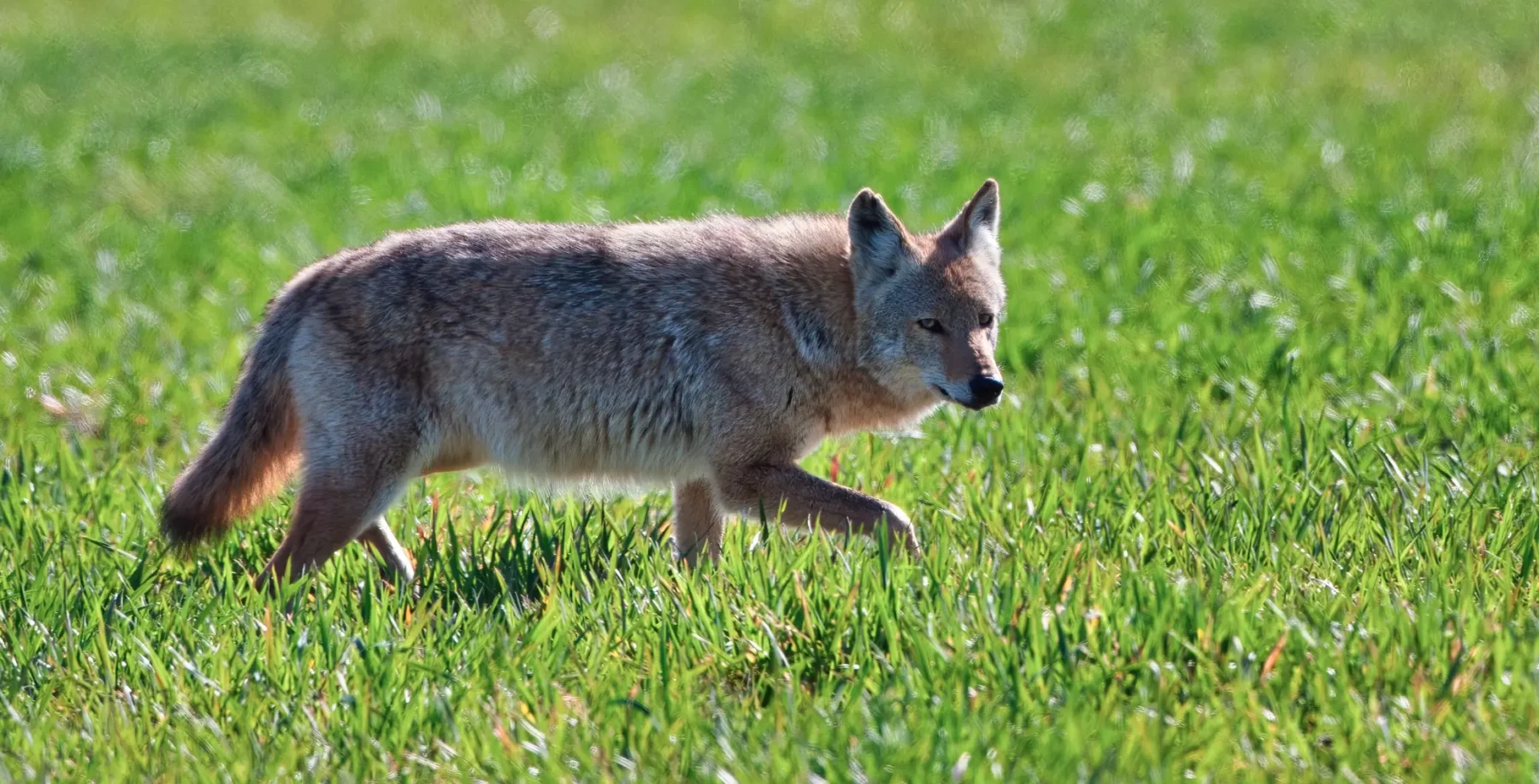
The ravine is also home to regionally rare plant species: blue cohosh, downy ryegrass, thin-leaved sunflower, russet buffaloberry and Hitchcock’s sedge. Deer, beaver, foxes and coyotes are reported several times a season, and in the spring visitors are thrilled by swarms of Red Admiral butterflies. The area’s also a significant stopover for migratory birds, and serves as nesting grounds for our own populations. Over 100 species have been spotted, including grebes, herons, kinglets, mergansers, hawks, swallows, woodpeckers and terns.

A descendent of the Annis family, among the first non-native families in the area, once told a story to the effect that as the Americans looted our city in April 1813, British soldiers buried their money in Gates Gully, a treasure never since recovered. It’s also said that William Lyon Mackenzie hid out at the Annis homestead, evading government forces in 1837.
At the bottom of the trail is Passage, a sculpture by Marlene Hilton Moore resting on the shore of the lake, honouring Doris McCarthy and the Bluffs themselves. McCarthy built a house on the Bluffs in the late 30s. Singer Lorraine Segato once house-sat there, which gave McCarthy the idea of making it an artists’ refuge. Now the property is owned by the Ontario Heritage Foundation.

Walk two: Passmore Forest L’Amoreaux Park
Access: L’Amoreaux Community and Rec Centre, west of Kennedy off McNicholl
After descending a steep staircase and ambling north along the path, we come to a plaque near the bridge over West Highland Creek. It’s informative, but I discover a far more interesting read later: the Report On The Stage 3-4 Salvage Excavation Of The Alexandra Site. In 2000, people doing preparatory work for a housing development north of the park discovered ceramic sherds, and a full-scale archaeological assessment was ordered.
Eight months of excavation unearthed a 600-year-old Huron-Wendat village thought to have supported a population of 800 to 1,000, with 16 or 17 longhouses plus sweat lodges and hearths. Remarkably, over 19,000 artifacts, including stone tools and weapons, copper beads and pipes were recovered. Perhaps the most significant discovery was beads made from seashells believed to have originated on the Atlantic, demonstrating the First Nations far-reaching trading network.

We find guerrilla art on the path, a set of human footprints that transform into wolf paw prints I’d like to extend a personal “Well done!” to the artist. The path forks, and the northwest trail proceeds to the shady bliss of Passmore Forest, named after F.F. Passmore, the surveyor responsible for Scarborough’s first official surveys in 1850 and 1862.
The wood-chip trail that rolls out before us leads through a mixed forest peppered with mature sugar maples, American beech saplings and fine examples of white pine and red oak. Scattered throughout are numerous trees hollowed out by decay, and there’s lots of pileated woodpecker and wood-boring insect activity. If you visit in early summer, it teems with flowering raspberry, fern and some of the most outrageous patches of burdock I’ve ever seen.
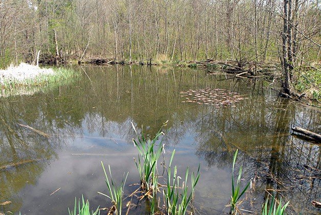
All the trails loop back on themselves we choose the southern one. Beams of sunlight breach the canopy, and the cool breeze causes the leaves to flutter and flash. L’Amoreaux Pond plays host to foxes, skunks, raccoons, squirrels and chipmunks. Garter snakes, crows, blue jays and brown-headed cowbirds are regularly spotted. One avian resident provides us with the greatest thrill one spring day – a great blue heron.

Walk three: Cedarvale Ravine
Access: Ava and Everden, near Eglinton West station
This ravine was a favourite haunt of Ernest Hemingway, who while writing for the Toronto Star Weekly back in 1919 lived at 1599 Bathurst. Nice to know this legendary adventurer enjoyed the swath of green, though it did acquire a checkered history.
In the 1970s, during the digging of the Spadina subway, there was intense construction throughout the ravine. Happily, thanks to the passage of time and re-naturalization projects, the area has largely recovered.
The ravine follows the course of Castle Frank Brook, a tributary of the Don that once flowed southwest here. Sometime in the 1960s, the city buried the brook as well as Cedarvale Creek and converted them into part of the Spadina Storm Trunk Sewer. The effects on the valley and wildlife can only be imagined.
Another major potential threat? The Spadina Expressway. If it had been constructed as designed, Cedarvale Ravine would be roadway today. Homes were expropriated and a large trench dug in Cedarvale Park, but vehement protests succeeded at halting construction in 1971.
Despite the damage, the area has recovered with considerable grace. Descending into the ravine, we discover a diverse landscape populated by both native and invasive trees and other flora: white pine, red osier dogwood, crack willow, cockspur hawthorn, sumac, yellow-flag iris and greater lobelia, to name only a few.
Tiny streams run through the ravine, criss-crossing the trail under footbridges of various shapes and sizes. In fact, much of the valley near the Bathurst bridge is full-fledged wetland, one of the few gifts given by the subway system beneath your feet.

Walk four: East Don Parkland
Access: Leslie and Sheppard
Walking the southern end of the East Don Parkland, you’re actually traversing what in the early 1800s was Clark’s Settlement or Clarksville, one of the first communities in the area. The village had a smith, school and church but no tavern, since founder Thomas Clark was anti-liquor. His home, protected under the Ontario Heritage Act, still stands today at 9 Barberry Place.
Proceeding north on the trail, we come to a small encampment covered in signs with religious messages nestled near the riverbank. Could this be the home of Toronto’s Peace Lady, who appears in flowing white waving peace signs on bridges? She’s called this ravine home for years.
We walk under the railway bridge, and soon the East Don makes a U-turn and becomes a tiny babbling rapids between steeply inclined banks. A new landscape emerges peppered by black cherry and wild apple trees.

Roughly 200 metres past the rapids, at a major fork in the trail, we head north and discover a small pond that in springtime is a landscape of pure joy with its cattails and (invasive) yellow iris.
The path edges along the border of Alamosa Park, in the heart of what was once called Flynntown. This small settlement, with its brickyard, farms and mills, was one of the early towns lining the Don. The stretch between Alamosa and Finch is truly idyllic. Undulating groves of deciduous and coniferous trees give way to sweet little meadows. In the spring, there are Red Admiral butterflies and patches of wild strawberries along the path. Bracket fungi decorate fallen, moss-covered trees. And all the while the river approaches and retreats from the trail.
Mother nature, however, does not deserve exclusive credit for the grandeur. Since the formation of East Don Parkland Partners in 1999, volunteers have planted 15,000 trees and shrubs – an amazing accomplishment.

Walk five: Vale of Avoca Rosedale Ravine
Access: Heath northeast of St. Clair subway station
There’s an evocative bit of Toronto folklore about how St. Clair got its name. In the 19th century, the thoroughfare was called the 3rd Concession and passed through the farmland of a family named Grainger. After watching a theatrical production of Uncle Tom’s Cabin, the story goes, a young Albert Grainger adopted “St. Clair” as his middle name, after the character Augustine St. Clare, who vows to free his slave. (It was incorrectly spelled in the program.) To amuse himself, Grainger erected a sign near Yonge reading “St. Clair Avenue,” and the name stuck.
At the bottom of the steep wooden staircase we come upon the only stretch where Yellow Creek, a historic tributary of the Don that was buried a century ago, sees the open air.
Following the trail south, we approach the graffiti-covered St. Clair Viaduct. It was built in 1924 to replace an older iron bridge some of that ironwork was then used in the fence that now separates the ravine from Avoca.

Half a kilometre along the trail from the viaduct, you can climb out of the ravine to the Rosehill Reservoir. Constructed in 1873-74, it was Toronto’s first major reservoir. Originally it was open to the air and freely accessible, but during WWII, out of fear that it might become a strategic target, it was fortified with barbed wire fences. In 1966, after the Cuban Missile Crisis, it was roofed to protect the water from radioactive fallout in the event that the Cold War turned hot.
On the east side of the creek, a flat, paved trail crosses under a railway bridge at the ridge that, some 12 or 13 millennia ago, was the shoreline of glacial Lake Iroquois.
Just past the Yellow Creek inlet is David A. Balfour Park. It has always struck me as odd that municipal politician Balfour (1889-1956) would be honoured with a namesake park. To his credit, he did much to advocate for city improvements, including Nathan Phillips Square, but on the other hand, he was also an opponent of the labour movement and petitioned passionately for bans on a number of books now considered classics, including John Steinbeck’s The Grapes Of Wrath.
Crossing Mt. Pleasant south of Roxborough, we find the Park Drive Reservation, a small re-naturalized meadow planted specifically as butterfly habitat. We soon turn right at a nexus of trails and come to a path that was once Milkman’s Lane, built in the latter half of the 19th century and said to have been the route of dairy workers delivering milk and eggs from farms in the Don Valley.

Walk six: Oxbow Trail Todmorden Mills Wildflower Preserve, Don Valley
Access: Pottery Road west of Broadview
This trail may well be one of our most wonderful 15-minute hikes, the kind of amble that can be squeezed into even the busiest day.
It was nearby at the end of the 18th century that Isaiah and Aaron Skinner built the first grist mill on the Don. By 1823, the Helliwell family brewery and distillery had been established the environs were named Todmorden after that family’s home in Lancashire, England. A few years later, one of the first machine-made paper mills in Upper Canada opened, producing newsprint for William Lyon Mackenzie’s newspaper, The Colonial Advocate. From this area once flowed some of our great staples: flour, paper and booze.
We enter the trail from the southeastern end of the parking lot, the location of a prisoner of war camp during WWII. Members of the German merchant marine were confined here in tents and huts while working at the Don Valley brick works and the Greenwood clay pits.
The Wildflower Preserve used to be overrun by invasive species like dame’s rocket, Manitoba maple, garlic mustard, Himalayan balsam and others. Almost 75 per cent of the biomass was invasive or introduced species. Thanks to passionate volunteers, the situation has improved. The trail leads through a lush and lovely meadow populated by wild bergamot, Michigan lily, grey-headed coneflower, common milkweed, Kentucky bluegrass and others. The meadow is also home to the dreaded dog-strangling vine a sign directs visitors to report sightings to the Invading Species Awareness Program. Their website lets me snitch on invaders with a tap of my phone.
Soon we skirt a heaviy forested area of sycamore, sugar and silver maple, American elm, trembling aspen and white ash and regionally rare red cedar. I come upon a flight of wooden stairs and cross boardwalk bridges. Marsh-like conditions in spring and summer support swamp milkweed, Jerusalem artichoke, marsh marigold, cow parsnip, spotted jewelweed and more. Moss-covered logs serve as homes for countless creepy-crawlies and majestic examples of bracket fungi. Then comes Todmorden Pond, where I’m told snapping turtles and red-eared slider turtles are in residence.
Jason Ramsay-Brown is author of the blog Toronto Ravines & Trails With Abbey, a journal of his explorations in city ravines and green spaces with his six-year-old daughter. abbey-trails.blogspot.ca.
All photos by Jason Ramsay-Brown


